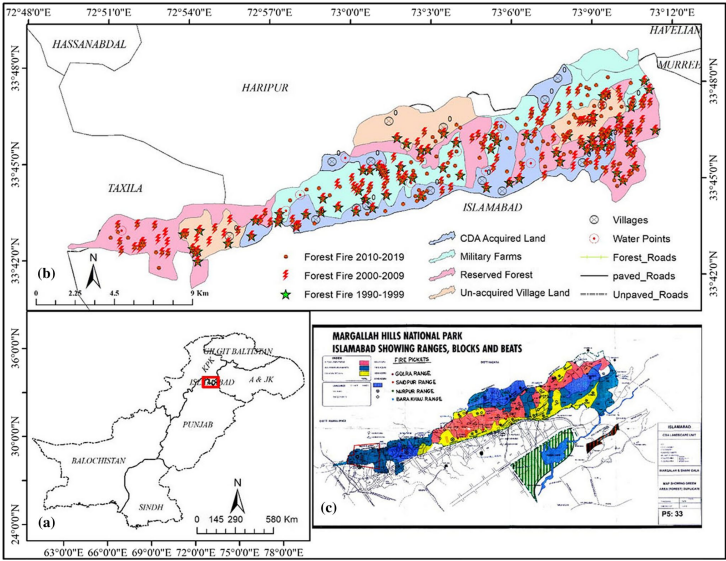
Spatio-temporal Forest fire monitoring using spatial-statistical and Geo-spatial analysis of factors determining forest fire in Margalla Hills, Islamabad, Pakistan
The spatio-temporal changes in burnt area were identified using Landsat satellite data and modeling was used to predict the fire ignition and size distribution daily and yearly. Forest fire ignition models are effective ways to predict


